This document describes an ongoing, experimental effort. The tool and methodology are currently in active development and field testing.
Working in Heritage-Dense Territory
Terra Ignota’s projects take place in territories where layers of human presence — ancient and recent — are written into the landscape. Moving through such environments, even with non-invasive methods and an ecological rather than archaeological orientation, carries the responsibility to notice and to document. That reality calls for care, and for close collaboration with the experts and community institutions that hold responsibility for local heritage knowledge. It is out of this ongoing commitment that we started developing a lightweight, open-source mobile GIS survey tool — a practical methodological response to the specific demands of working in these landscapes. In the frame of CAZ we started to work on that idea together with Robert Carracedo Recasens.
The Urgency of Documentation
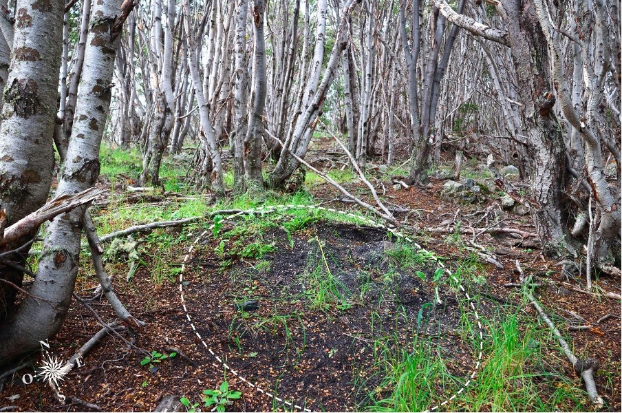
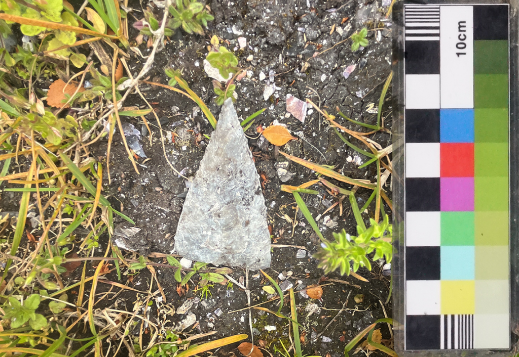
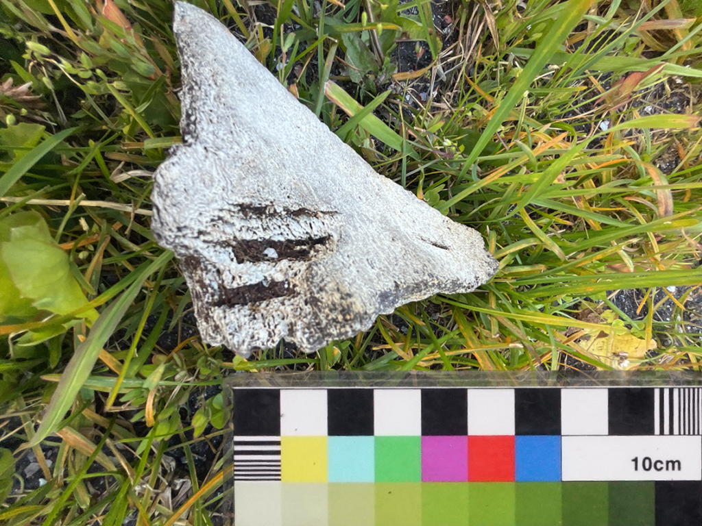
On the ground in Ponsonby, shell middens and other surface heritage sites are visibly under pressure. Feral animals excavate the ground, directly exposing cultural material that has been undisturbed for centuries. Once exposed, objects are vulnerable — to weather, to erosion, and to removal by visitors who may not know that such material should be left in place and reported rather than handled or taken.¹
This is something the Terra Ignota team observes directly in the field. A finding recorded with a precise location and a timestamp — even by a non-specialist — creates a reference point that experts can act on. An unrecorded observation, however careful, cannot.
The obligation to register accidental findings is, in many jurisdictions, not merely good practice but a legal requirement; structured mobile GIS recording serves as both an instrument of compliance and a contribution to regional heritage knowledge. As a lightweight tool that should be also handed back to local communities itself.
The Tool
The increasing digitisation of field methodologies has significantly transformed archaeological practice over the past two decades, particularly through the adoption of Geographic Information Systems (GIS) and, more recently, mobile GIS applications. While early GIS integration primarily focused on post-fieldwork spatial analysis, contemporary tools such as QField enable direct data capture, processing, and validation within the field itself. Dimara et al. (2024) identify this gap — between traditional post-excavation GIS workflows and the need for real-time, in-situ data recording — as one of the central challenges driving current innovation in digital field documentation.² This shift reflects a broader methodological transition from fragmented analogue workflows toward integrated digital systems that prioritise consistency, accuracy, and immediacy in data recording.
A central concern in field methodology remains the consistent and systematic registration of findings. Standardised documentation is essential not only for ensuring data quality but also for enabling comparability across projects and facilitating long-term archiving and reuse. Traditional paper-based recording systems, although still widely used, introduce multiple points of failure, including transcription errors, data loss, and delays in digitisation. Mobile GIS solutions address these issues by embedding structured data schemas directly into fieldwork practice.
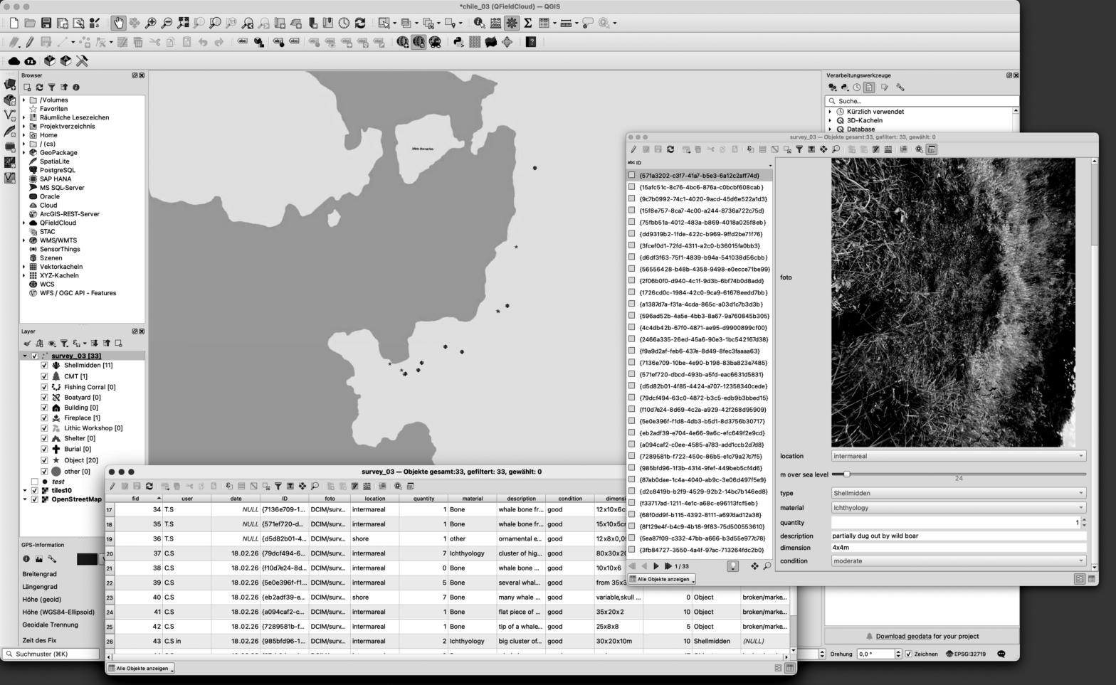
The tool is built on QField, the mobile companion to the open-source desktop GIS platform QGIS, and is designed to ensure that accidental encounters with heritage material are captured in a form that is precise, reviewable, and useful. Three considerations shaped this choice:
- Open source and freely accessible. Both QGIS and QField are free to use, available across platforms (Android, iOS, Windows), and maintained by an active international developer community. The tool can be adopted and adapted without institutional licensing, and the data it produces remains in open, non-proprietary formats (GeoPackage, GeoJSON) — readable and migrable regardless of what software or institutions exist in the future.³ For a research platform operating across national and institutional boundaries, and in collaboration with community institutions with limited technical infrastructure, this is a prerequisite for equitable partnership.
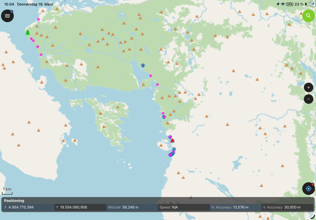
The open-source principle also opens an ethical question: how accessible should these systems remain when the heritage contexts they document are vulnerable? The protection of sensitive sites — and the cultural sovereignty of Indigenous communities to whom many findings historically and culturally belong — cannot be resolved by technical or institutional means alone. It requires ongoing dialogue between specialists, civil society, and the communities themselves. - Built for offline environments. Fieldwork rarely happens where the internet is reliable. QField is designed for exactly this: projects are configured on the desktop, packaged with offline map tiles and attribute forms, and deployed to the device. All recording happens locally and is synchronised when connectivity returns. For teams working in remote, rural, or infrastructurally fragile territories, this is not a convenience feature — it is a prerequisite.⁴
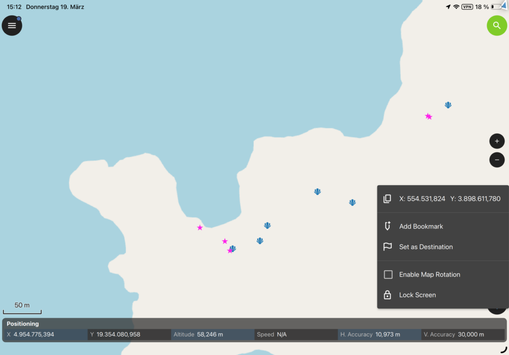
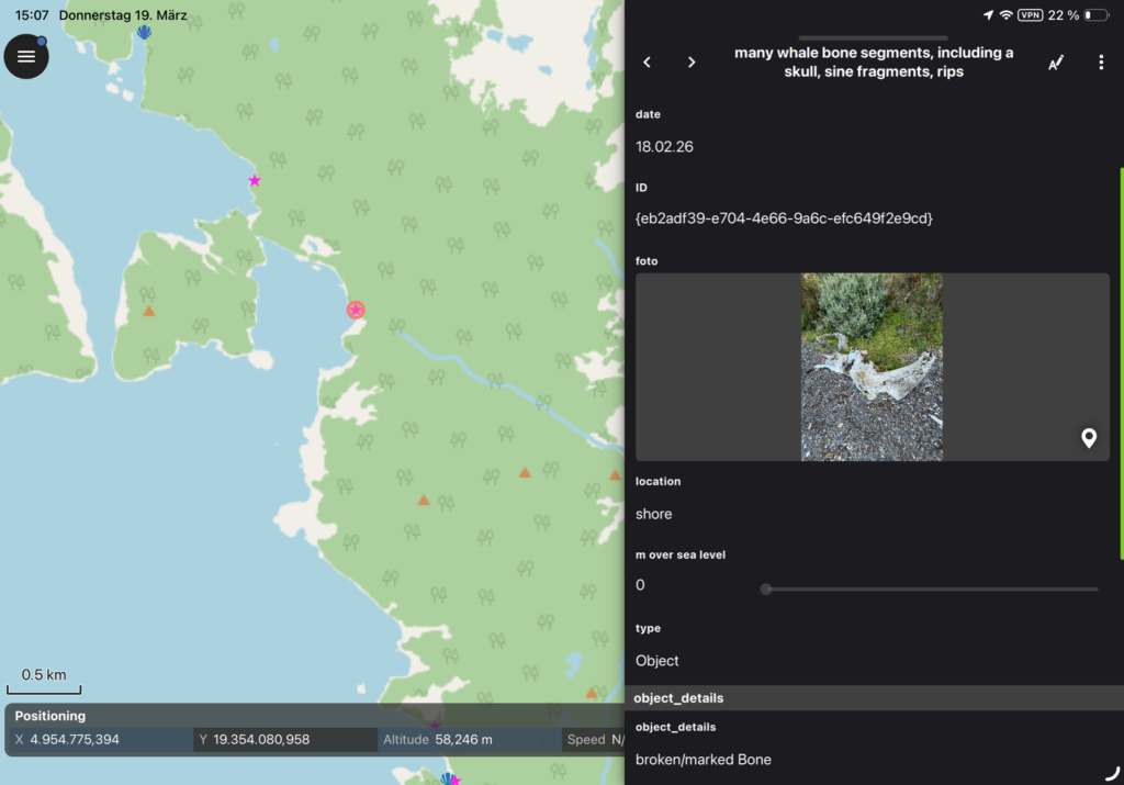
- Structured, spatially referenced recording. Every entry in QField is automatically geolocated at the moment of observation. Photographs, category classifications, and field notes attach to a precise coordinate — eliminating the transcription errors and ambiguities that characterise paper-based or informal digital recording. The result is a database, not an archive: one that can be filtered, mapped, and analysed rather than simply stored.⁵ ⁶
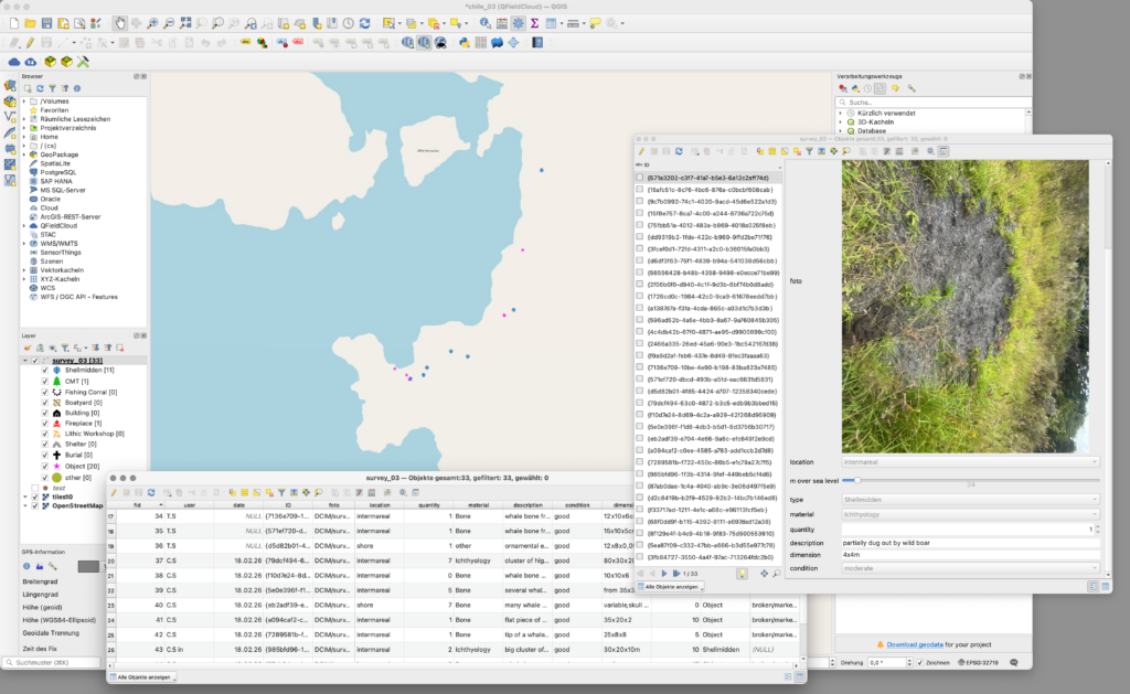
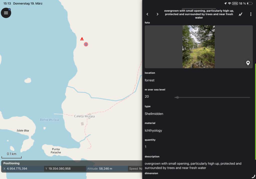
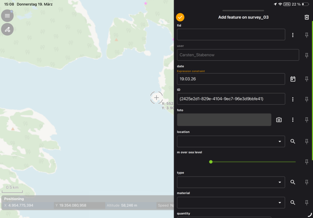
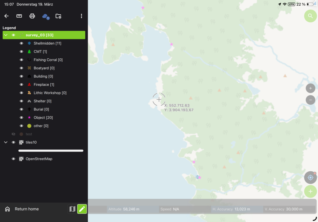
What the Protocol Records
The recording protocol currently under development is structured around a small set of core attributes: unique ID, app user ID, geographic position (GPS marker), date, location topology, class/category, material category, photographic documentation, quantity, dimensions, condition, altitude (metres above sea level), and a free-text description field. The form is intentionally minimal — designed to be completable in the field in a few minutes. It does not ask practitioners to interpret what they find — that interpretive work belongs to the experts and heritage institutions the team works with. Tripcevich (2004) argues that well-designed mobile GIS forms lower the threshold of participation in systematic recording without lowering the quality of the data produced.⁷
Current Status
The tool is in its test phase. Work currently underway includes:
- Configuring the QGIS project with attribute forms, layer structure, and controlled vocabularies appropriate to the Ponsonby context, in consultation with the team’s archaeological expertise
- Integrating drone mapping data as offline base layers
- Testing QField deployment across the range of devices used by CAZ field lab participants
- Conducting initial field trials to assess usability under real conditions
- Developing the shared data structure and review workflow together with collaborating heritage experts and institutions
Images, field testing documentation, and notes on methodological decisions will be added to this page as the work develops. The development process itself is considered part of the research.
Situating the Effort
The integration of mobile GIS tools into non-specialist fieldwork is increasingly documented in the literature. QField has been evaluated in field survey contexts worlwide⁸ ⁹ and combined with UAV documentation in ways directly analogous to the CAZ drone-to-ground workflow.¹⁰ Beyond the registration of individual findings, the tool also serves a broader function within Terra Ignota’s approach to the territory. The Emerging Archive framework conceives of the research zone as a vertical axis — from sub-oceanic geology through the human layer (AnThropos) to the atmosphere — treating the territory as a living archive of matter, energy, and information across geological and human timescales. Within this framework, the GIS survey tool contributes to the AnThropos layer: grounding the vertical mapping approach in geolocated, structured field observations that can be integrated with drone data, acoustic recordings, and ecological surveys into a shared spatial dataset. What this effort adds to the established archeological practice is a different disciplinary starting point — a research practice oriented toward ecology and artistic inquiry, reaching toward systematic documentation as an ethical commitment to the landscape, to the community that knows it best, and to the responsibility that comes with working in a place this dense with time.
Notes
¹ Carracedo Recasens, R. (2025). Wulaia Cove, historical and archaeological evidence. https://terra-ignota.net/radiales/caleta-wulaia-historical-and-archaeological-evidence/
² Dimara, A. et al. (2024). An Innovative System for Enhancing Archaeological In Situ Excavation through Geospatial Integration. Heritage, 7(5), 2586–2619. https://doi.org/10.3390/heritage7050124
³ Open Source Geospatial Foundation (OSGeo) (2024). QGIS Project. https://qgis.org
⁴ QField Documentation (2024). QField for QGIS – Efficient Field Work. OPENGIS.ch. https://qfield.org/docs/
⁵ Saba, G. (2025). Mobile-GIS as a Solution for the Archaeological Survey. International Research Journal of Scientific Studies, 2(1), 1–12. https://doi.org/10.64383/irjss.JAN250101
⁶ Montagnetti, R. & Guarino, G. (2021). From QGIS to QField and Vice Versa. Environmental Sciences Proceedings, 10(1), 6. https://doi.org/10.3390/environsciproc2021010006
⁷ Tripcevich, N. (2004). Flexibility by Design: How Mobile GIS Meets the Needs of Archaeological Survey. Cartography and Geographic Information Science, 31(3), 137–151. https://escholarship.org/uc/item/5ng484c1
⁸ Jansen, I. et al. (2023). Evaluating QField as a Mobile GIS Solution for Archaeological Survey. Proceedings of the 46th Annual CAA Conference. https://doi.org/10.15496/publikation-87753
⁹ Mayoral Herrera, V. et al. (2022). Archaeological Survey Supported by Mobile GIS. Advances in Archaeological Practice. https://www.cambridge.org/core/journals/advances-in-archaeological-practice/article/archaeological-survey-supported-by-mobile-gis/F9256BFD28565EB2FF5136E45EACBCEB
¹⁰ Mandorlo, A. (2024). Discovering and Recording Archaeological Features during a Survey Using an Unmanned Aerial Vehicle and QField. Proceedings, 96(1), 2. https://doi.org/10.3390/proceedings2024096002
The project is supported by the QFieldCloud Non-Profit Program.