On the origin and habitability of the landscape in fjords and channels of Tierra del Fuego
The region of fjords, channels, and archipelagos south of Tierra del Fuego is characterized by rugged terrain, with high and steep mountains bordered by deep incised valleys that even govern the underwater landscape. Its origin ingeniously links tectonic and climatic processes, embracing persistent uplift as a result of endogenous folding and faulting, as well as depressions and exhumations caused by the weight and carving of glaciations.
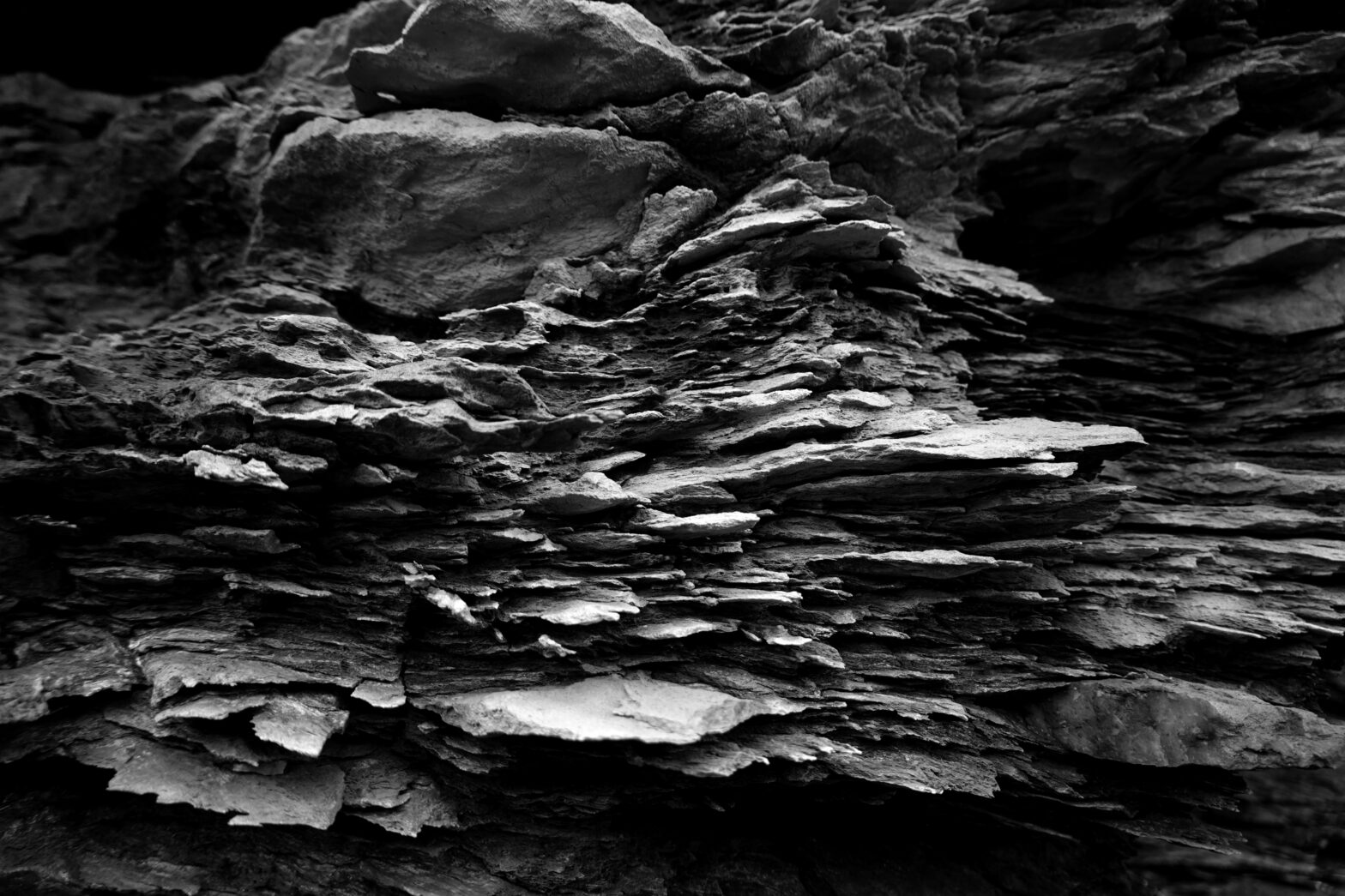
Tectonics have continuously generated, earthquake after earthquake, the development of a complex network of faults and fractures, many of which reach the surface, creating jumps in the landscape as well as zones of weakness. Pleistocene ice masses, on the other hand, have taken advantage of the slopes and areas of weakness (high concentration of fractures and rocks crushed by faults) to settle and advance. Glaciers in their upper parts have eroded and polished mountains, defining the high peaks of the Darwin Range. Moreover, as they moved, they dug and smoothed wide valleys with gentle profiles, many of which were invaded by the sea in resonance with the melting of the ice and the rising average sea level.
Collectively, these exposed geological forms represent an aggressive territory, with high mountains still covered in ice, draining tumultuous rivers. The vegetation that is observed today only managed to establish itself and adapt after the retreat of the last ice sheets, around 14,000 years ago. The native fauna also managed to populate the territory before it became an island. Thus, the first Homo sapiens migrated through this area from north to south until they encountered this icy, rugged, and mountainous landscape in the south. What motivated the exploration towards the south, into increasingly hostile territories? Could it be that our modern concept of landscape hostility is an invention of humans acclimated to the comfort of our homes and leisure?
The rocks that form the Darwin Range, as well as the mechanism that deformed and uplifted them above sea level, date back to the Late Cretaceous period, about 70 to 80 million years ago. It is part of the Andean orogenic system, with the uniqueness that the colliding tectonic plates are the South American and Scotia plates. The boundary between these plates has evolved over time, currently transitioning from a convergent to a transform boundary. Today, it is possible to appreciate the morphological impact of this transform boundary on the surface, known as the Magallanes-Fagnano Fault. This fault is seismically active and represents the primary tectonic feature in the region, with a length of over 1000 km.
Thus, a significant part of the geometric and geographic organization of fjords and channels is controlled by the Magallanes-Fagnano Fault and its subsidiary faults. For example, the Kent Pass connects two valleys oriented WNW-ESE, partially cutting through the middle portion of the Darwin Range. This morphostructural alignment represents a subsidiary branch of the Magallanes-Fagnano Fault (Figure 1). These valleys continue to carve out, and the faults in the area are still moving.
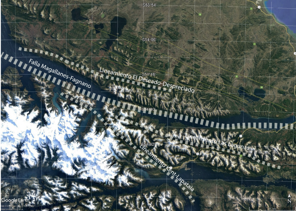
Figure 1. Satellite image from Google Earth of the southern sector of Tierra del Fuego. Snow-capped mountains and glaciers in the Darwin Range, as well as the network of fjords, channels, and lakes, can be observed. Yellow lines indicate fold axes and thrust faults in the foreland of Tierra del Fuego. Dashed white lines indicate the Magallanes-Fagnano Fault and some of its subsidiary faults, referred to as morphological alignments here. This fault system represents the tectonic boundary between the Scotia Plate to the south (where the Darwin Range is located) and the South American Plate to the north.
However, the modern landscape has been influenced by anthropogenic activities, both directly and indirectly. Modern roads and human settlements occupy remote areas of the landscape to provide access to economic activities. On the other hand, the landscape has been modified by the actions of beavers (Castor canadensis) through dam construction, logging, and flooding. These mammals, the second-largest rodents on the planet after capybaras, were introduced to Tierra del Fuego by Argentine military personnel in 1946, where they found an ideal reproductive environment but lacked natural predators. Today, they pose a threat to the ecosystem and are the most damaging invasive species on the island of Tierra del Fuego and its surrounding archipelagos. Along with guanacos, they are the mammals that have best adapted to the Fuegian landscape. However, similar to humans on a global scale, their lack of predators threatens to deplete the landscape’s resources that currently sustain them.
(by Dr. Gerd Sielfeld)