This research aims to get in tune with the intensities, turbulence and heterogeneity of the the masses of moving air based in Wulaia/Ponsonby. I would like to generate experiences that allow us, in a sensitive way and with rudimentary technologies, to tune in to (1) the complexity of chaotic movements that make up the winds (2) and how this invisible activity shapes not only the physiognomy of the landscape but also the biological activity that inhabits its surface.
Since the beginning of modernity, lines of thought have developed that seek to standardize definitions, concepts, ideas and classifications in a debatably reductionist manner. Thus, based on real biological arguments, humanity is conceived as a single species; the creation of the universe has been synthesized in elegant equations; the diversity of language is fixed in univocal dictionaries; and the continuum biological fragments into discrete classifications, overlooking the complexity of its interstices.
The study of the complexities of the wind uses unconventional tools to identify the diversity contained in “the wind” and establish a dialogue that emerges from the invisible heterogeneity of its core.

Ponsonby / Wulaia
The area located on the eastern side of Ponsonby Sound presents geographical characteristics that translate into a significant discontinuity in climatic and biological patterns. The high peaks of Hoste Island, on the western coast of Ponsonby Sound, the narrow access from the Beagle Channel to the north through the Murray Channel, and the extreme climatic conditions of the Drake Sea as it exits to the south, make this Sound a natural, but at the same time turbulent, refuge. This generates moderate climates and conditions conducive to life, despite the surrounding adverse climatic conditions, creating areas with high oceanic and terrestrial biological diversity, and including convergence zones and historical and ancestral human occupation.
It is believed that this marine ecosystem was the place of convergence of the largest population of the Yagan people, with a long spatial and temporal history. The above, partially supported by archaeological surveys in which a large number of shells were found, located on the eastern coast of the Ponsonby Sound, specifically between Wulaia and Bahía Inutil, shell deposits that exceed 3 m in height on several occasions.
Furthermore, both the growing interest in this area for commercial activity and the potential of the Murray Channel to be an international passage to Antarctica, suggests this place as a node of anthropic attraction, an efficient passage and even more; reiterated.
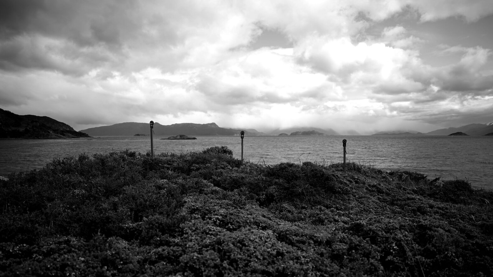
The device.
To be able to tune into these complexities, an instrument will be built that consists of three anti-aircraft attack sirens that will rotate using blades driven by the wind.
The three identical mills, located at a distance of 2m each, will be activated creating a composition of supplies, phases and rhythms that will be specific to the place where they are located. This tool will be used as a means of exploration to analyze how different wind patterns relate to the physiographic and biological characteristics of the place.
The choice of the siren as a central part of this instrument is based on the emergency situation in which this robust and at the same time fragile oceanic and coastal ecosystem finds itself. Taking into account the implications and meanings of an alarm in times of tension and geopolitical upheaval on a local and global scale, I believe it is appropriate to use a signal that alerts the actions of the war machinery (tormentum/storm) as well as the potential destruction of the natural/cultural heritage of the southern tip of the planet if due care and appropriate safeguards are not taken into account.
The following is a video of the preliminary wind study carried out south of Wulaia. In this test, three anemometers were installed two meters apart, oriented towards the wind.
The following is an example of the emergent sound relationships that would occur in a siren. For these purposes we convert the Km/h and scale it by a common factor of 80. (*)
11.8 km/h —> 131.33 Hz
14.4 km/h —> 160.0 Hz
15.1 km/h —> 168.0 Hz
The following is a render of as would work the installation on the ground.
Around this tool, a comparative study will be created, through sounds, of the influence of different wind patterns, intensities and turbulence, to speculate on their influence on the generation of vegetation discontinuities on the coastal edge and their relationship with the presence of historical and ancestral anthropic activity. Furthermore, this tool aims to be a transdisciplinary meeting platform that allows speculation, if necessary, the contrast of ideas through other types of validators.
(*) To convert wind speed from km/h to Hz, we follow these steps:
1 Convert km/h to m/s: 1 km/h = (1000 / 3600) m/s = 0.2778 m/s
2 Apply the anemometer calibration constant: We use the relationship 1 Hz ≈ 2 m/s, which implies: 1 m/s = 0.5 Hz
3 General formula: f (Hz) = v (km/h) × (1000/3600) × 0.5