By Florencia Curci, Victor Mazón Gardoqui & Nicolás Spencer.
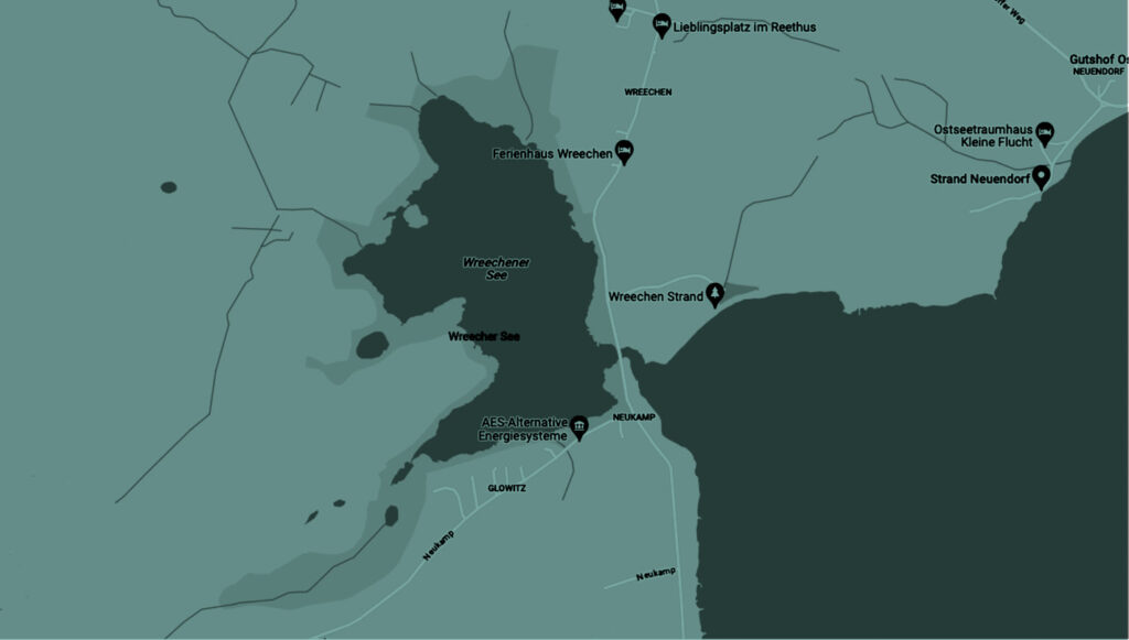
On the last day of the research trip, three actions were developed for the Wreechen Strand beach. This location has been crucial in the research as an ideal place for wind-related projects, adopted as a hub to carry out different site-specific collaborative actions.
The moving air transports, drags and reflects matter-energy-information as a complex ecosystem of slow adoption in the configuration of reality given in language, and therefore poorly perceived and described in the direct experience of our bodies.
This gaseous macro-organism takes on a scopic, auditory and haptic presence when the particulate material it carries has sufficient density and volume to concentrate clouds (not only of water) or when it collides with solid surfaces it manages to create whistles, hums, roars and vibrations.
The wind cannot be perceived in its body unit (except satellite) and therefore it is partially drawn through its effects. In fact, in etymology the word storm, for example, has its origin in the clouds of arrows launched in unison by rival groups (from Latin: tormentum).
Our practice oscillates in the tension between giving body to the unintelligible and revising the corporeal in its dematerialization. In the chain of affiliations of this meteorological practice comes the idea of Ether. A substance already discarded and that until the 19th century was considered a hypothetical fluid in charge of transmitting all kinds of energies. Until then, first alchemists and then scientists, using sound as a test element, determined that this was not transmitted in a vacuum, there was something elusive carrier of the information they were experiencing. While the ether was the paradigm, the light propagated by this element defied the laws of pre-modern physics opening a field of contradictions that stimulated for a long time suggestive and extravagant ideas bordering on spiritualities. Whatever the case, the presence of the meteorological was always explained by the direct experience of the bodies in a partial and exaggerated way.
Strength-oscillation-signal
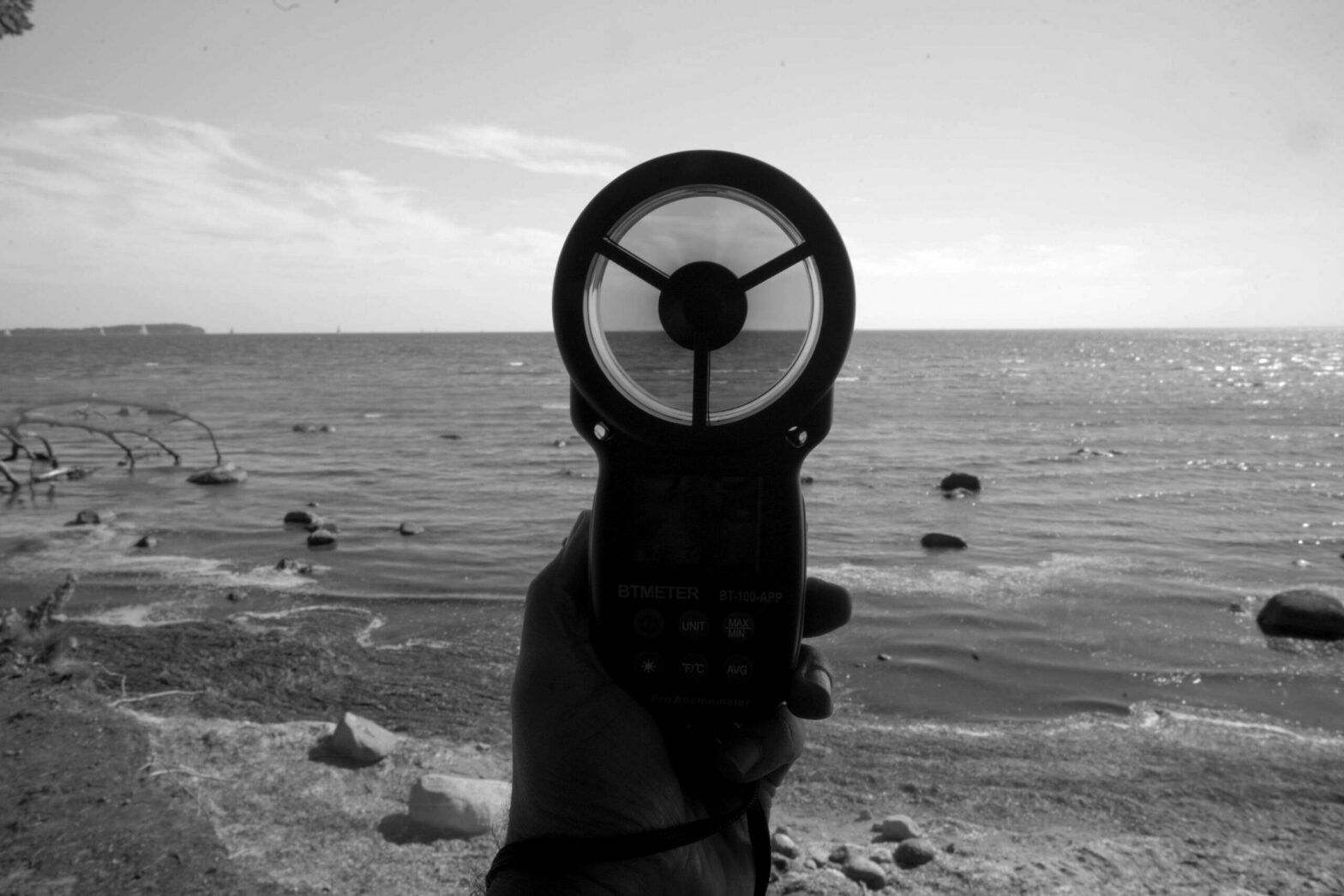
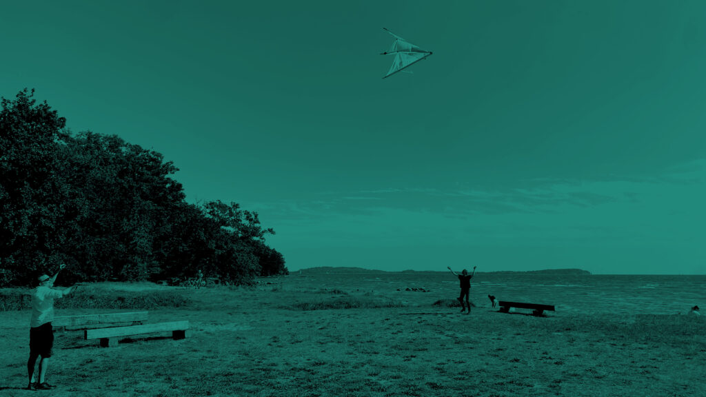
Wreechen Strand beach 16.9.2023 – 11:10AM -15:35PM
Sunny day 21 to 23°, Wind 18-20kn S-E direction with a constant propagation without gusts.
The exercises correspond to tests of three weather machines built during the preceding Sonic Island days by the Curci-Mazon-Spencer team: Wind Generator (HLB), Kitenna (KTN) and Wind Oscillator (OSC).
keywords: force, oscillation, signal.
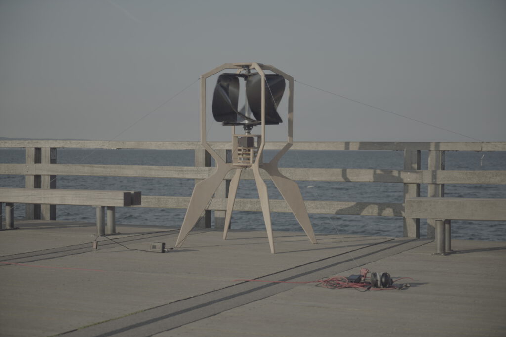
Action 1 – Holobionte
The beta prototype of the Holobionte project comprises a first module of a self-sufficient, replicable and decentralized system for measuring intensities between macroorganisms and the different entities with which they are related. Each module must, by means of some self-sufficient technology -in this case wind power- manage to electromechanically feed different measurement and data transmission devices.
The beta prototype is intended to be replicated -with the optimizations of the experimental-, easily transported, interconnected and used virally as a tool to empower civil data. The entire prototype is open source and open hardware.
Assembly and start-up tests were carried out. The load of 12v batteries was measured in 18-20kn wind. The sensor devices included in an environmental data logger that we call IGNOTA LOGGER managed to capture: soil measurements (N, P , K, EC, PH, Temp, Humidity, CO2, Gas, Presion, UV level, Full light spectrum and a time signature within YYYY/MM/DD HH:MM:SS:mm) adding for this last actions wind intensities, signals outside the audible range, light inside and outside the visible field and soil properties without the need for invasive interventions (suitable for archaeological prospecting).
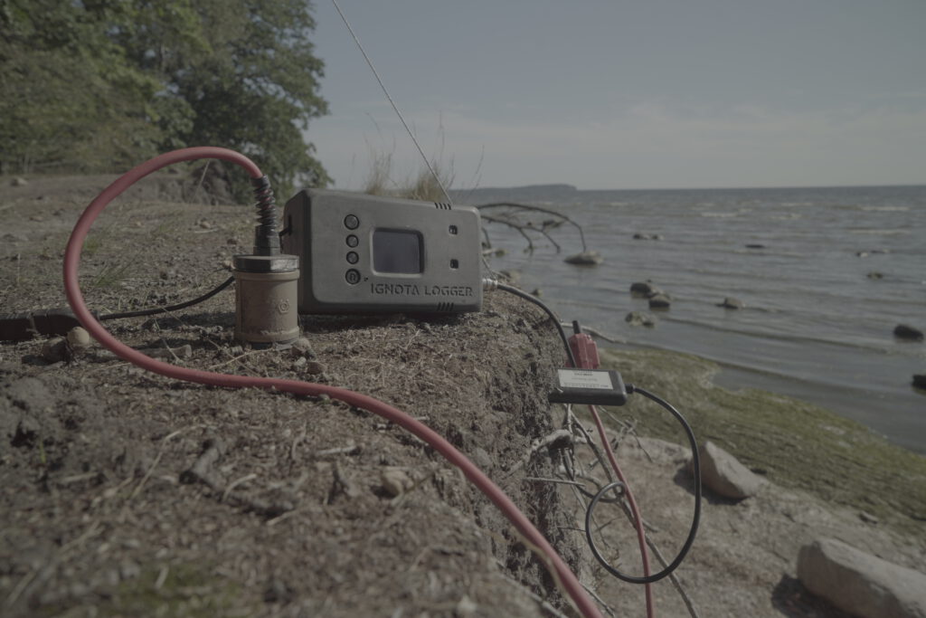
The concept behind the Ignota Logger, as the name implies, is an instrument that stores data specially designed for the Terra Ignota project. The concept came up after listening to the archaeological team discussing their techniques and methodologies of observing the paths and traces while on terrain research activities. It was important to design an open source hardware tool to measure, record and analyze data in real time, through a portable device with measures in correlation to disturbances on the geological level according to human settlements. This led me to start to sketch a soil sensor to measure levels of nitrogen, phosphorus, potassium, which its related to the fertility of the soil, this was extended with extra sensors to measure electro-conductivity -amount and type of soluble salts in soil moisture-,Ph levels and get the acidity or alkalinity of the soil and detect the disturbances on site and being able to identify the settlements through the altered values measured according to the dumpster and shells. This original design was expanded to measure external variables in parallel like the atmospheric temperature, humidity, barometric pressure, altimeter, VOC gases, ultraviolet (UVA) light sensor, infrared, full light spectrum and a 6-axis Motion tracking device (3-axis Gyroscope, 3-axis Accelerometer).
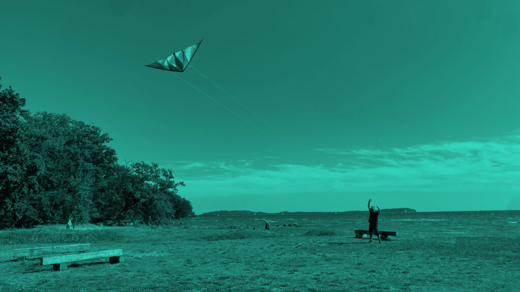
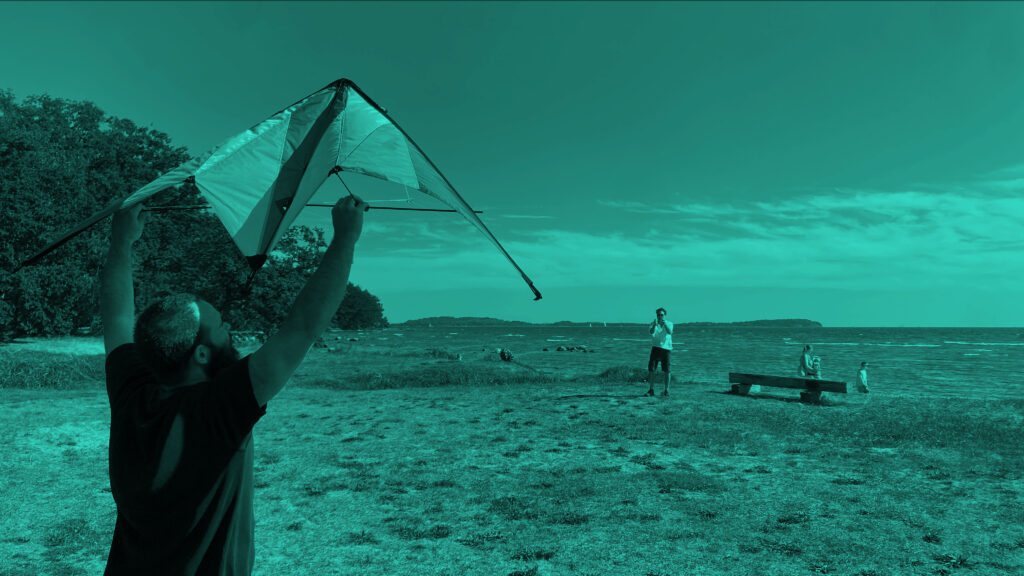
Action 2 – Kitennas
For this action three different kite antennas as lifters for scientific/weather/artistic research were build in order to analyze their stability and behavior. This action was delayed to the last days in search for the adequate location and wind. On the Wreechen Strand beach we measured a constant 13 to 19 Km/h during the 5 hours we where making the actions, enough to flight with adequate control two of the three designed kites and a professional bought kite.
In earlier times, kite lifters served a broader spectrum of purposes beyond meteorological applications. Notably, kites played a pivotal role in the historic Marconi experiments over a century ago. On December 12, 1901, the groundbreaking event of transmitting the first radio signal across the Atlantic took place, spanning from Cornwall, England to St. John’s, Newfoundland. A kite served as the antenna lifter at the receiving station in St. John’s. Illustrated here is the antenna-lifting kite used by Guglielmo Marconi in his pioneering endeavor. The featured kite is known as the Baden-Powell Levitor, bearing a striking resemblance to the Rokkaku, a Japanese design often abbreviated as the ‘Rock.’ Unlike the original Marconi receiver kite, which exhibited limited stability, the Rokkaku proves to be a highly effective system for lifting antennas and is readily available at most major kite retailers.
We carried out this research according to the in view of possible applications in long distance transmission devices and the establishment of vertical sensing nodes in remote territories for the construction of future three-dimensional cartographies.

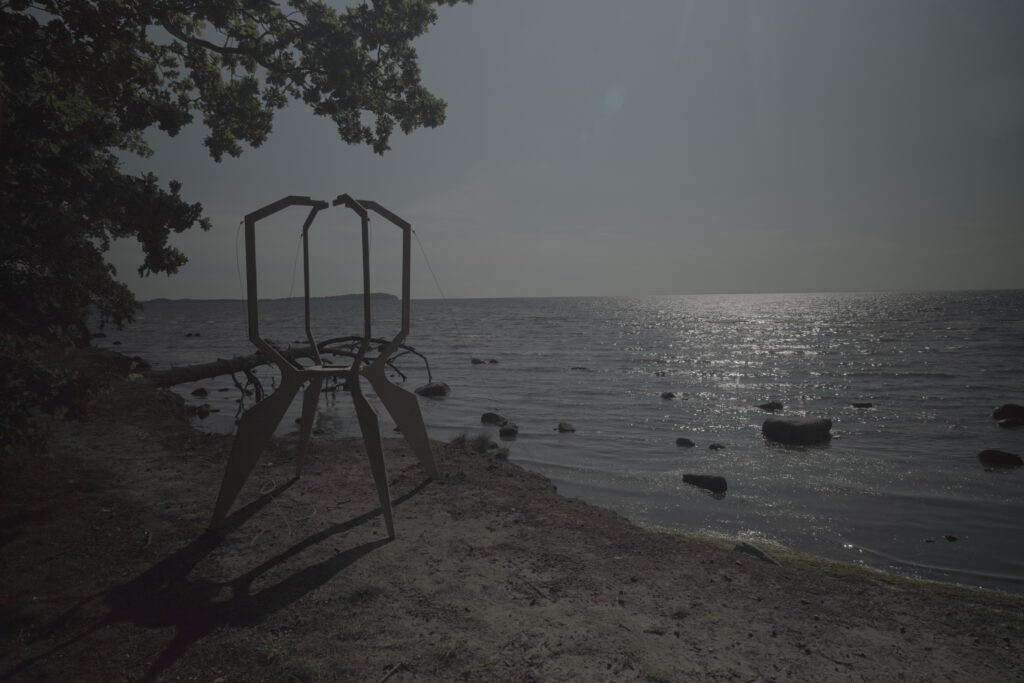
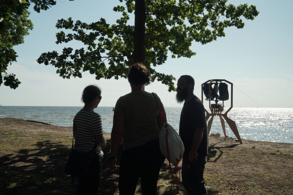
Action 3 – Oscilador
This practice is a mirror exercise of Terra Ignota Fuego-Patagonia. It is the simplest form of measuring intensities of moving air through string tuning. In the register of perception, this machine operates as an oscilloscope on a landscape scale.
This time, lightweight materials were used that allowed different variations of air masses to be perceived in small spaces. What is considered “wind” is evidenced, through listening to the oscillators, as the union of many flows that are configured in complex systems of intraspecific interaction.
This test was carried out as a prototype, using different systems of strings and a variation on the number of the arrangements in 3 scales and horizontal plans. The establishment of listening stations in remote territories that promote the furtive encounter with the sound of planetary vibrational energy flows.